RN23, Rarotonga, Cook Islands
Thumbnail profile: Rarotonga
With 10,000 residents, Rarotonga is the most populous of a group of fifteen islands known as the Cook Islands. Located in the South Pacific Ocean, northeast of New Zealand between French Polynesia and Fiji, these islands are just south of the equator and east of the International Date Line.
Their total 241 km² land area is spread over 2.2 million km² of ocean, an area as large as Western Europe. They are divided into two distinct groups: the six older atolls of the Northern Cook Islands and the nine larger Southern Cook Islands.
History
The Cook Islands were first settled in the 6th century AD by Polynesians migrating from Tahiti to the southeast. The first European landing was made by a Spaniard, Pedro Fernández de Quirós in 1606, who called the inhabitants Gente Hermosa, the "beautiful people".
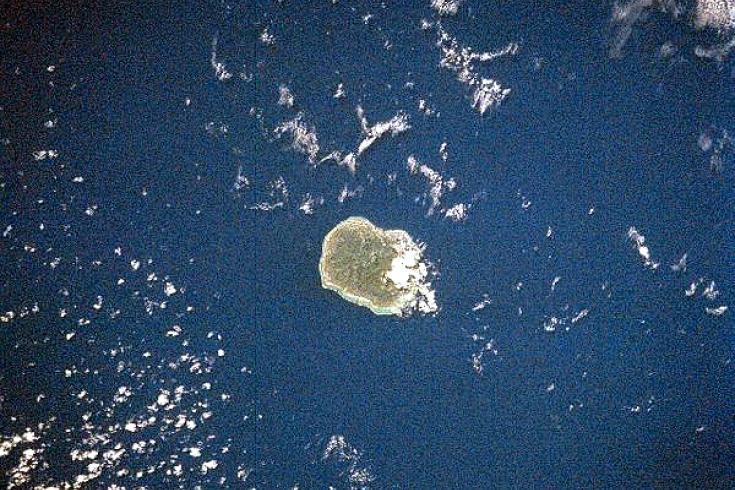
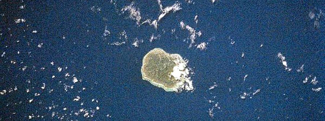
Satellite view of Rarotonga
British navigator Captain James Cook arrived here in 1773. The name "Cook Islands", in his honour, first appeared on a Russian naval chart published in the 1820s. In 1888, at their own request, the Cook Islands became a British protectorate. Transferred to New Zealand in 1901, they remained a protectorate until 1965. Since then, the Cook Islands—K?ki '?irani in the local Maori—have been a self-governing parliamentary democracy in free association with New Zealand.
In 1985, the Rarotonga Treaty created a South Pacific Nuclear-Weapon-Free-Zone. It banned the use, testing and possession of nuclear weapons within the borders of that zone, which includes Australia, the Cook Islands, Kiribati, Nauru, New Zealand, Niue, Papua New Guinea, the Solomon Islands, Tonga, Tuvalu, Vanuatu and Western Samoa.
In 1985, the Rarotonga Treaty created a South Pacific Nuclear-Weapon-Free-Zone. It banned the use, testing and possession of nuclear weapons within the borders of that zone, which includes Australia, the Cook Islands, Kiribati, Nauru, New Zealand, Niue, Papua New Guinea, the Solomon Islands, Tonga, Tuvalu, Vanuatu and Western Samoa.
In 1888, at their own request, the Cook Islands became a British protectorate.
When the French Government resumed nuclear testing at Mururoa Atoll, about 2000 km east of Rarotonga, in September 1995, the Cook Islands’ Prime Minister Albert Henry dispatched a vaka — a traditional voyaging canoe — with a crew of Cook Islands traditional warriors to protest near the test site. French testing ceased in January 1996 and the French Government declared a moratorium on future testing, in preparation for signing the CTBT in September 1996. France closed down its test sites in the South Pacific in 1999.
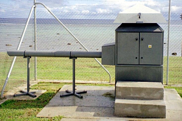
The originally installed French-made ASS 500 air sampler.
Geology and Climate
Today’s coral atolls—sunken volcanoes topped by coral growth—were formed by volcanic activity. Rarotonga Island is actually an extinct volcano that rises 4,500 metres above the ocean floor, its highest peak measuring 658 metres above sea level. The island is 32 km in circumference and has an area of 67 km². At its base, some 4,000 metres deep, the volcano is nearly 50 km in diameter, which suggests the amount of volcanic activity that has taken place here over the ages.
The larger southern islands are the continuation of the Austral Islands, lying along the same north-east / south-west fracture of the Earth's crust. The interior of the islands is dominated by eroded volcanic peaks cloaked in dense vegetation and remains largely unpopulated due to forbidding terrain and lack of infrastructure.
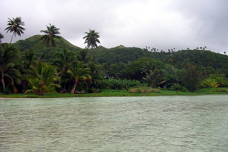
The island is surrounded by a lagoon that extends several hundred metres to the reef, which then slopes steeply to deep water. To the southeast, particularly around Muri, the lagoon is at its widest and deepest. This part of the island is the most popular with tourists because of the lagoon's suitability for swimming, snorkelling and boating. The climate is moderate to tropical.
The larger southern islands are the continuation of the Austral Islands, lying along the same north-east / south-west fracture of the Earth's crust. The interior of the islands is dominated by eroded volcanic peaks cloaked in dense vegetation and remains largely unpopulated due to forbidding terrain and lack of infrastructure.
The island is surrounded by a lagoon that extends several hundred metres to the reef, which then slopes steeply to deep water. To the southeast, particularly around Muri, the lagoon is at its widest and deepest. This part of the island is the most popular with tourists because of the lagoon's suitability for swimming, snorkelling and boating. The climate is moderate to tropical.
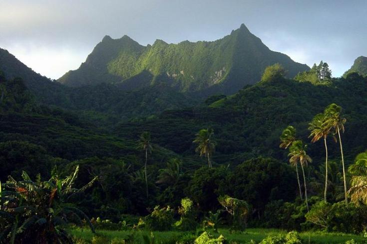
The interior of the islands is dominated by eroded volcanic peaks cloaked in dense vegetation.
Station Location
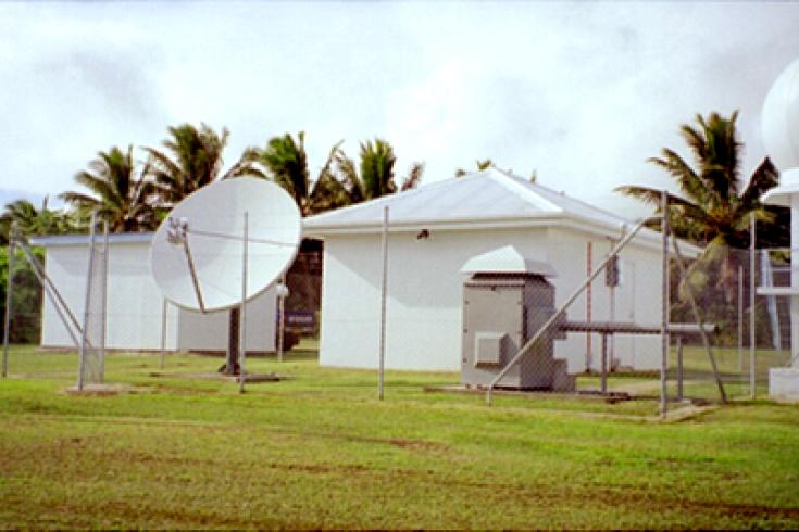
The radionuclide station RN23 is located on the premises of the local meteorological bureau. To the left in the visual is the Very Small Aperture Terminal (VSAT) antenna, and to the right is the French-made ASS 500 air sampler. The counting facility that houses the detector, which counts the radioactive particles in the sample, is behind the station.
The National Radiation Laboratory, the institute designated by the Government of New Zealand and the Cook Islands, has been operating radionuclide stations for many decades. There has been one at this site for at least 30 years, which was established mainly to monitor fallout from nuclear testing in the region. Data from the existing station were sent to the Prototype International Data Centre (IDC) until new equipment was installed. Learn more about how the radionuclide technology works.
The National Radiation Laboratory, the institute designated by the Government of New Zealand and the Cook Islands, has been operating radionuclide stations for many decades. There has been one at this site for at least 30 years, which was established mainly to monitor fallout from nuclear testing in the region. Data from the existing station were sent to the Prototype International Data Centre (IDC) until new equipment was installed. Learn more about how the radionuclide technology works.
The radionuclide station RN23 is located on the premises of the local meteorological bureau.
Radionuclide Station Profile
RN23 is a manual station originally equipped with a French-made ASS 500 air sampler, later replaced with a Finnish-made SENYA Snow White air sampler. The meteorological instrumentation is located at the meteorological station nearby and complies with the World Meteorological Organization’s (WMO) requirements, both in terms of equipment and location. This system is connected to the station control computer.
Since data transmission started in August 2000, no major difficulties have been encountered and the satellite link has been stable for most of the time.
For security purposes, the station is entirely fenced off with all instrumentation placed in the same area. High level station management is performed by the National Radiation Laboratory (NRL) staff in Christchurch, New Zealand.
Certification, Testing and Evaluation
The site survey and installation were performed by NRL between November 1998 and February 2000. The station started sending data through the Global Communications Infrastructure (GCI) on a regular basis in March 2000, entering into the International Data Centre (IDC) processing in May 2000 and admitted to operational mode at the end of that month. The subseqent testing and evaluation phase confirmed that the station was performing well.
The certification visit in summer 2000 confirmed that RN23 stattion had been well-installed and was well-operated, the equipment having been purchased under a contract with the CTBTO's Provisional Technical Secretariat. Thus, RN23 was officially certified on 23 November 2000, only the third radionuclide station to receive certification in the planned globe-spanning network of 80-stations.
The Cook Islands also host auxiliary seismic station AS24, which is situated near radionuclide station RN23.
Learn more about Cook Islands and the CTBT.